Edmonton River Valley Learning Tour - Keillor Point West to Laurier/Buena Vista Parks (September 26, 2024)
Reflections and notes from a learning tour

Todays Ice Sculpture - A Learning Journey - Keillor Point West to Laurier/Buena Vista Parks
These are speaking notes used when I took my parks planning students on a bicycling learning tour on September 23, 2024. Discussions focussed on planning processes past and present, the landscapes they produced, and the activities, benefits and outcomes produced in Edmontons version of Central Park or Stanley Park.
Prologue
As we embark on this tour, we are reminded that the river valley has been home to indigenous peoples for multiple centurys, and then subsequently with colonial settlers who arrived from Europe. Settlers imposed their form of governance and relationship to the land through legislation that privileges some over others, creating what Heather Dorries called a racialized landscape. The creation of the parks themselves are colonial acts of settler colonial legislation, as are all table lands. The concept of a settler colonial vision for a river valley park in Edmonton was first raised early in the 20th century by Frederick Todd, an American landscape architect and a disciple of Frederick Law Olmstead. Since that time, parkies until recently housed in a functional planning department have been identifying and acquiring river valley parklands, working with urban land use planners. Parkies have been simultaneously working with civil society to help fund, program, and operate parks.
Keillor Point
Keillor Point has been pejoratively called “End of the World” park. This is a brief description of the site online:
“Located in the Belgravia neighbourhood, Keillor Point will be familiar to Edmonton natives as the former location of Keillor Road. It once connected Saskatchewan Drive to Fox Drive, but closed in the mid-90s. In the early 2000s, a landslide took place that wiped out a portion of the road leaving behind several pillars of a retaining wall. While the city had “no trespassing” signs put up for years, it became a popular — if not dangerous — lookout spot. Realizing its potential, the city put in formal infrastructure to make it a safe lookout point and it became open to the public in 2019.” (https://www.familyfuncanada.com/edmonton/the-end-of-the-world/)
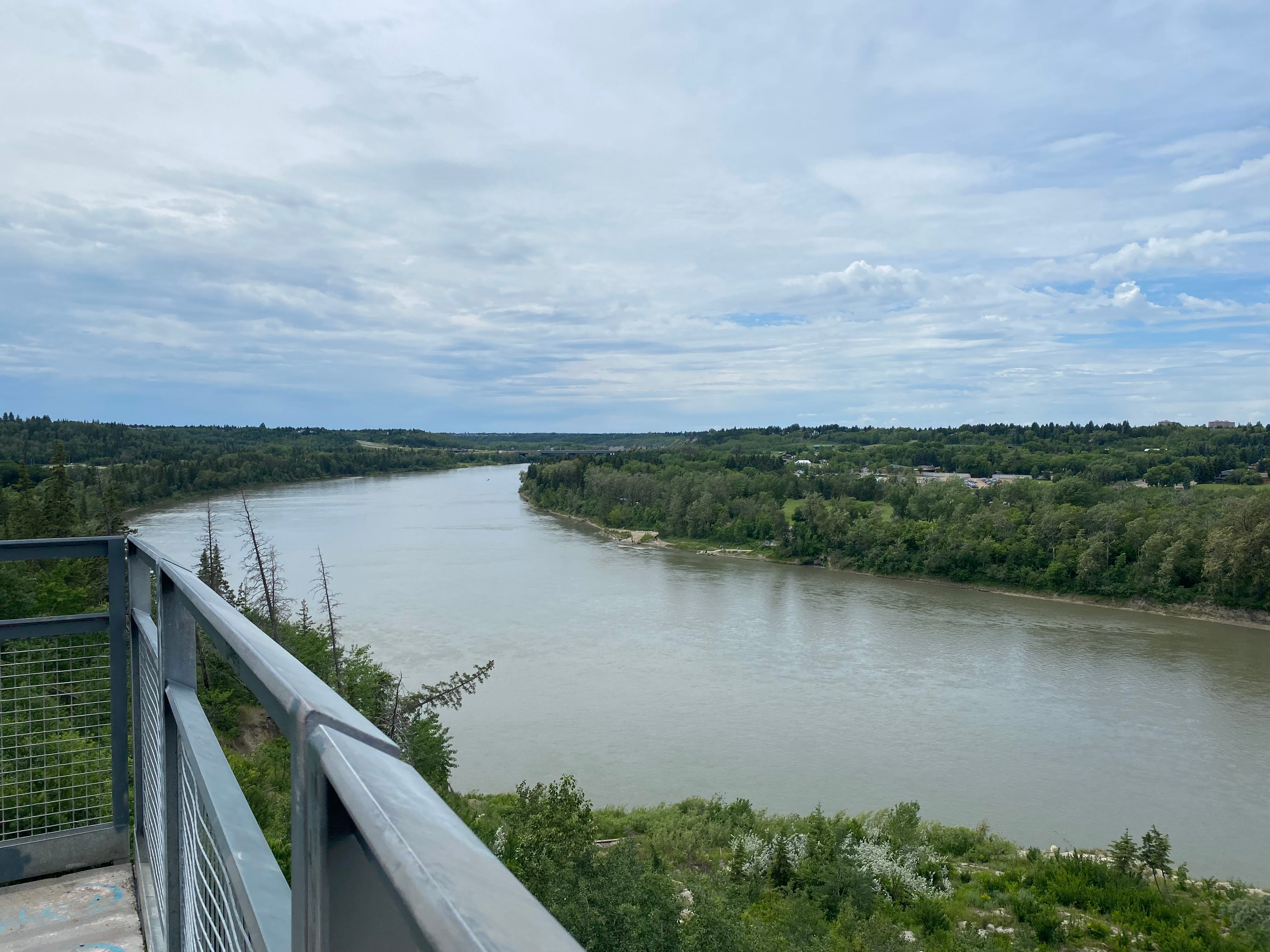
Keillor Point provides a high-level viewpoint of the river valley park system itself, including the heritage river. What you see from the site is the beautiful river, river valley and treed areas, with little sense of what programmes, amenities and activities are seen from this high-level perch. On planning maps, it appears as an almost undifferentiated green blob with little or no understanding or description. Keillor Point viewpoint is the physical connective tissue (i.e., property) between the neighbourhood and the river valley. It also provides a local site that not only provides a viewpoint but also a place of resting, a place for reflection, picture taking, a meeting place, reading, etc. It provides a nearby passive unstructured recreation site, part of the Windsor Park neighbourhood, that collectively form part of the city park system, that includes the river valley. Keillor Point is however not a site to play sports, climb on playground equipment, go to school, skate in the winter, etc. This is an important distinction because it begins to differentiate the role and purpose of each park site within the entire park system from a programmatic and amenity perspective.
The trail along Saskatchewan Drive we travelled was a deliberate approach of city fathers of the day to create publicly accessible places along the top of bank for the benefit of everyone, not limiting that primo view to million-dollar residential properties like those seen across the street. The 1970 to 1980 City Of Edmonton Parks Master Plan reconfirmed this approach of city fathers to take lands along the top of bank. This initiative was created through extensive public input managed by the Parks and Recreation Department. These lands would be called parkways. This approach was consolidated in the early 80s in a top of bank policy. The the development industry objected to this policy whose opposition grew until about 2010, when UDI with the support of the Sierra Club advocated for policy change with two key outcomes. First, the change took a stronger geotechnical approach to bank stability, which was a welcome improvement for all. Second, it also meant that the amount of parkway would be severely limited to 30% views from the roadways, while 70% of the top of bank allocated those parkway views to million dollar properties, save for a 3 metre asphalt trail behind expensive (unaffordable) homes for the few.
Stop 2: Whitemud Equine Centre, Whitemud Ravine and Fort Edmonton Park
We wound our way down into the river valley on a paved undulating asphalt trail sided by beautiful mature trees with leaves turning yellow and red, with fallen crunchy, colourful and sometimes smelly decaying leaves littering the trail, with the smell of horses mixed in for fun. It is also here where amenities and programmes become more physically visible. We stopped to talk about the programmatic and activity confluence of each of these “sites.” Whitemud Equine Centre originally opened in the 70s built on what was a family farm, providing access to horses and equine programming for horse enthusiasts, new and old, young and old. The trails in the area allow for horse use, a truly multi-purpose trail. An equine community foundation was formed (WECLA) to fund raise to create a more operational facility, at an approximate cost of $6.5M, that was approved by the City in 2014. Farming and horses are a part of our history and culture, inside and outside the river valley.
Whitemud Ravine Nature Reserve was an initiative by park planners in the original Ribbon of Green river valley plan to preserve an area with tremendous biodiversity on what was once a site of coal mining. Trails within the preserve do not permit bicycles. The ravine is also home to the tufa springs, which is an ecologically important feature that currently is not well protected. A description of the reserve is provided at this site. https://encf.org/walks/whitemud-ravine-nature-reserve/ In recent years the Alf Savage Centre was developed after public engagement processes that provides both meeting space for river valley groups and interests, as well as washrooms. The site is also a go to tobogganing site in the winter. The site demonstrates a different kind of programming and activity space, and its former life as a working landscape upon arrive of settlers.
Fort Edmonton Park was created in 1974 by the Parks and Recreation Department to celebrate and interpret Edmonton’s rich history. It includes streets of homes from the early 20th century moved from the developed areas as new homes replaced them. The development of this site continues today, reflecting our past and how the river valley and table lands were home to both indigenous peoples before and after settlers arrived. Like the Equine Centre, a fund raising and management board run the facility. Both facilities contribute to both tourism and their capital and operations contribute economically to the city.
The Talus Dome has a unique history. At a cost of $600,000 funded as part of the capital funding for nearby roadway improvements in a process managed by the Edmonton Arts Council, which is in itself a not-for-profit organization. The original site of the Talus Dome was to be on the other side of the river. The art is intended to reflect the co-existence of human-kind and the river valley. The piece is part of Edmonton’s permanent public art collection, and was designed by Californian artists Benjamin Ball and Gaston Nogues. The art is a physical representation of the City support for the arts community.
Finally, all of the above represent an important reality of parks in North America, based on the realities of settler colonial legislation. While park lands are provided in development processes, Alberta Planning Legislation does not require or mandate economic interests to fund park amenity development nor operations. This is important because it means that park managers must find multiple and diverse partners fund developments and provide services, unlike any other municipal services. For example, developers must provide land and pay for most if not all the costs of roads and utilities, later recovered from land purchasers. Park must also find partners to help reduce the cost of operations through community not-for-profit operations (i.e., civil society).
Note: Due to the close/connected reality of these Laurier and Buena Vista Park sites, in 2012, the City initiated a new park site master for the combined the Buena Vista and Laurier Parks. These two parks are bordered not only by the river valley but also by Edmonton’s Valley Zoo. As such coordination between all amenities was required. The Master Plan was approved in 2012 that included city council review, where public helped craft the plan and had opportunity to critique it. Physical development emanating from these master plans must also undergo subsequent capital an operating budget approvals, both of which are public approvals, and environmental impact studies.

Stop 3: Sir Wilfred Laurier Park or Laurier Park & Buena Vista Park
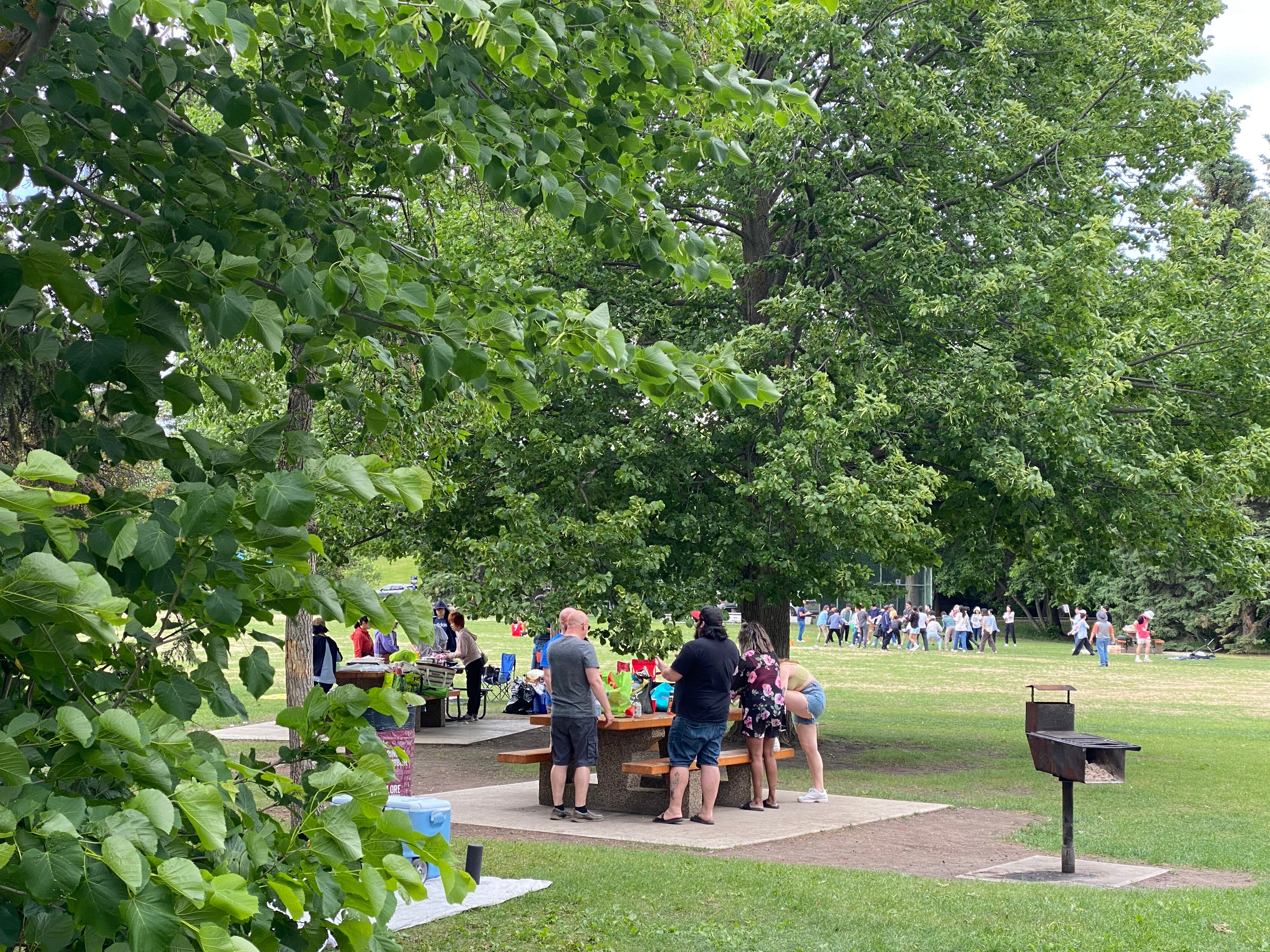
There two park sites provide free access to stunning treed river valley parks adjacent to and with access to the North Saskatchewan River. The parks fuse access to nature with open grassy areas, undulating and winding trail paved and gravelled access both east and west, picnic areas, historical natural playgrounds, park furniture, washrooms, picnic areas, sportsfields, as well as a boat launch. The sites provides places of four-season social gathering, for both active and passive recreation, some structured and mostly unstructured activities in a glorious natural setting providing close connection to nature. In the winter an ice rink is provided in an open grassy areas. Sir Wilfred Laurier Park was named after our 7th Prime Minister.
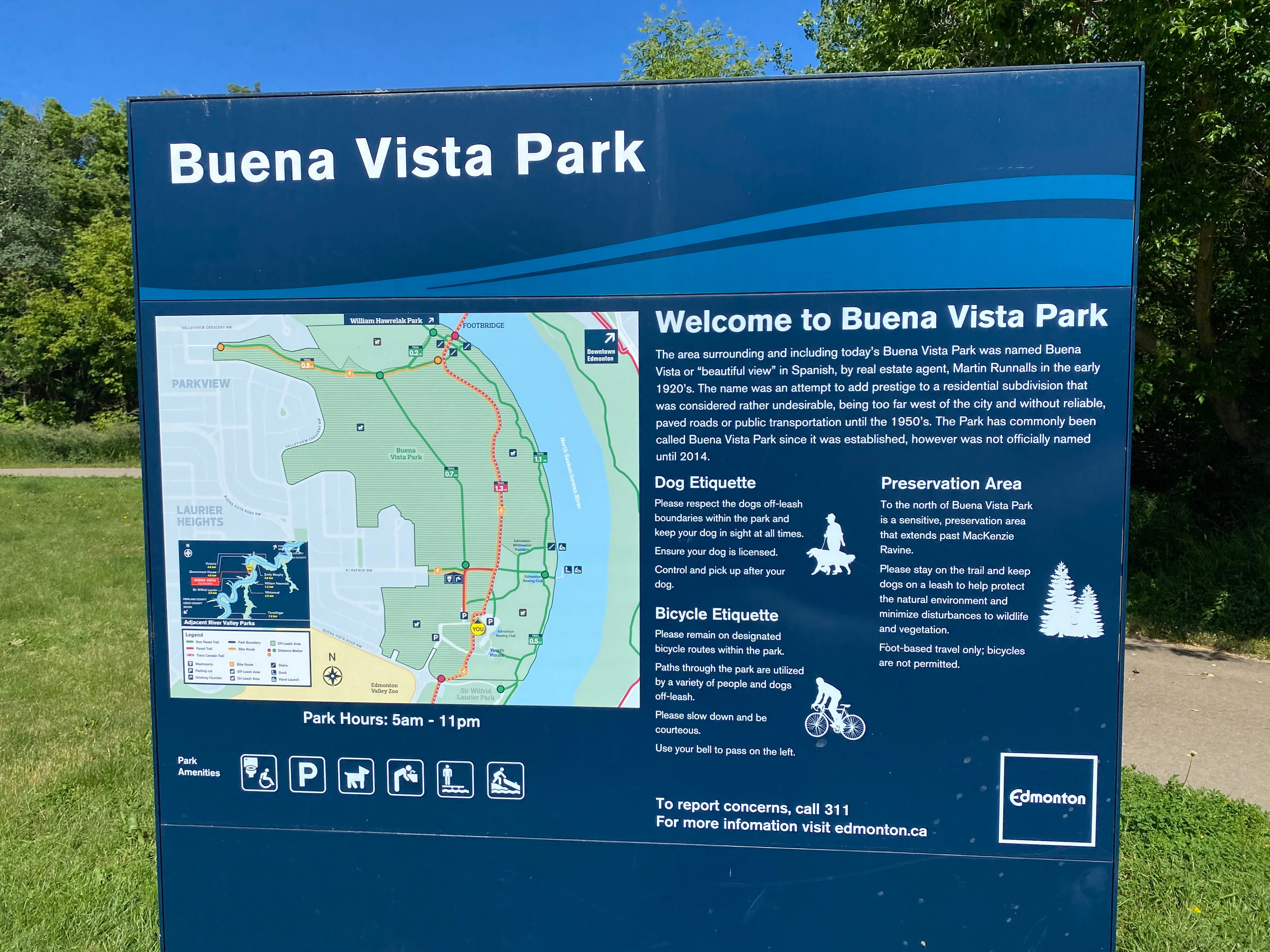
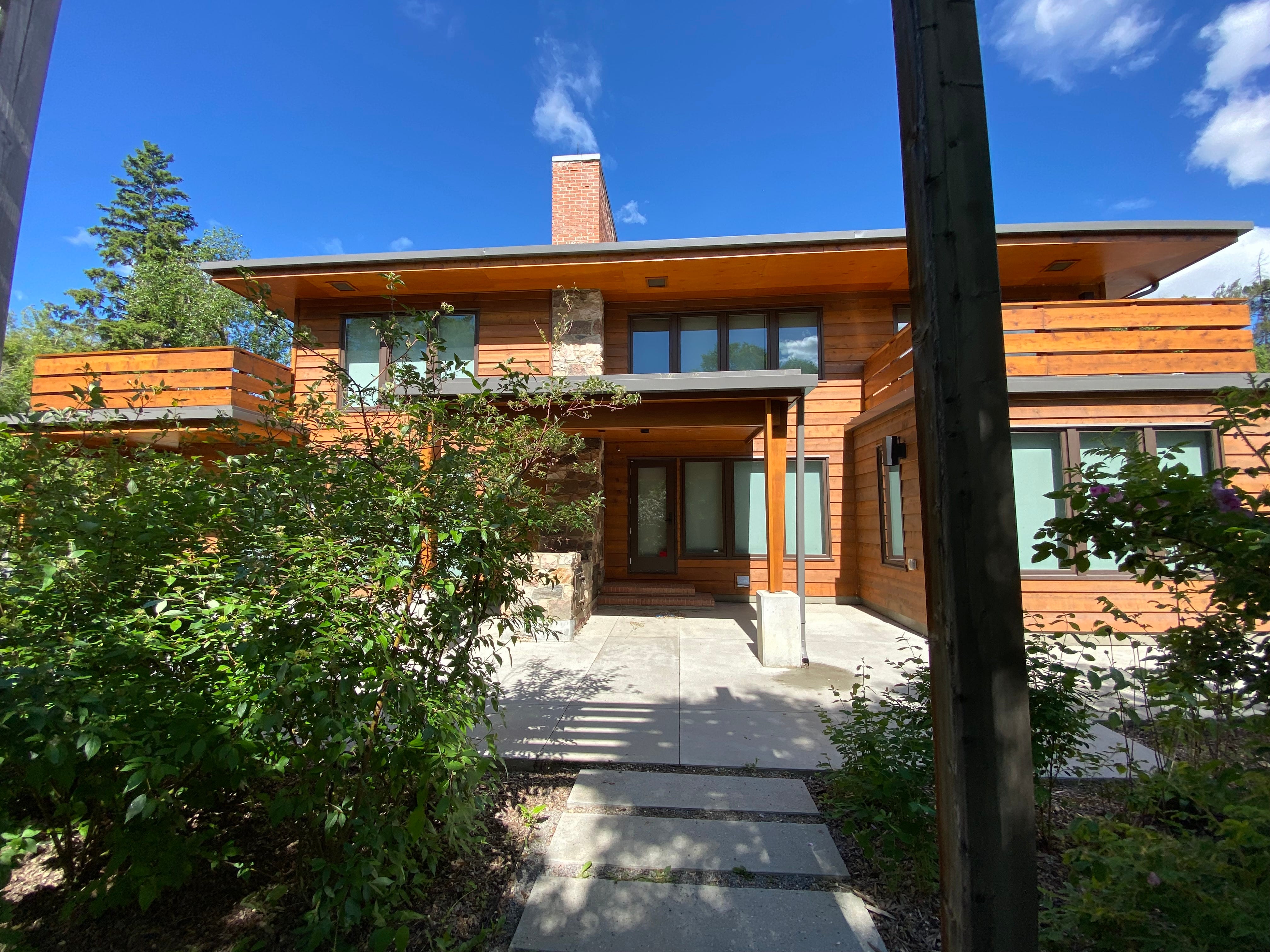
Buena Vista in spanish means beautiful views, which is very appropo for the site. Buena Vista Park is also the home of Yorath House. Yorath House is one of the last remaining homes developed in 1949. The charming two-story home was purchased in 1992, and later restored as a rental facility (not free) for small scale corporate retreats, weddings, community programs and family friendly events in the river valley. The redeveloped house includes a main floor event space, a second-floor multi-purpose space with a large terra. Also on site is public art that was part of the capital budget requirement for the restoration of the home.
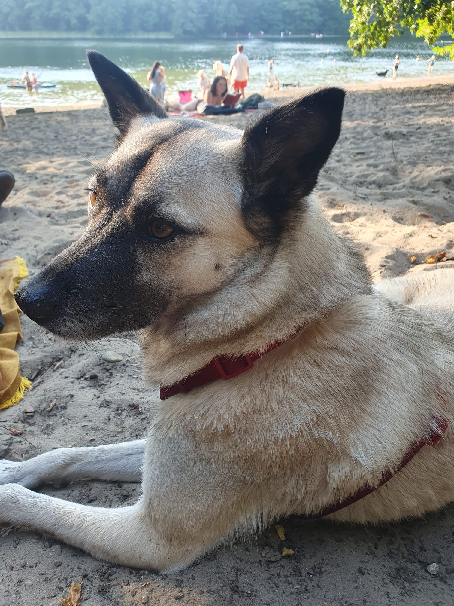
Also part of the Buena Vista Park is an off leash dog area. Dogs off leash on park lands were prohibited until the early 90s. Due to community opposition to that policy, the city created a pilot project of a dozen sites, not including this one. However by about 2010 the public was clamouring for more sites. A stand-alone study in 2016 created a city wide policy and plan, that included a dog off leash area in this location.
The Buena Vista/Laurier Parks provide multiple four-season overlapping programs and activities in a rich natural valley setting. The lands on which they reside are a large irregularly shaped parcel acquired through subdivision and purchase by park and land use planners. As large permeable surfaces they provide significant ecological goods and services, as well as both school programing and cultural events.
Closing Remarks
The tour focussed on the river valley intended to give you a cellular or visceral engagement with the river valley through your eyes, ears, nose, touch, skin etc. while demonstrating how small parts (i.e.., sites, activities) make up the whole (system, programmes, benefits and outcomes). Anecdotally I also shared historical and cultural realities of legislation, funding, and planning processes, which demonstrated the long and evolving history of the river valley from pre-settler times, demonstrating periodically contestations that helped shape our park system.